Where is the Lower Rock River?
Here, “lower Rock River” means the Newfane, Vermont, stretch from the Williamsville area down to where the Rock River meets the West River in Windham County, southern Vermont. It is not the full upper watershed.
Why is it called Rock River?
The name fits what you can see: a ledgy, cobbley southern Vermont brook-river. This page does not rest on a single dated naming record; it is the usual, descriptive toponym people still use for the channel between Williamsville and the West River.
Where does the Rock River meet the West River?
The confluence sits in the lower Newfane corridor near Vermont Route 30 and Depot Road—the same cluster of roads and pull-offs people use to find legal parking and posted trails. Use the site map and on-the-ground signs; a visible gravel bar is not the same as public access.
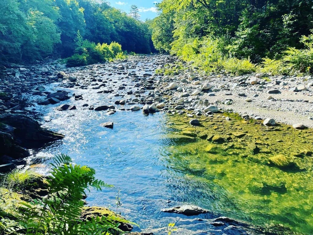
Why does the Lower Rock River have deep pools?
State stream notes for the mouth (T02.01) describe ledge, deep pools, riffles, and gravel bars—hard bedrock and moving water, not a flat sand bottom. That is why the channel still forms those green holes after a storm scours the shallows.
What is special about the Williamsville reach?
In one short walk you get the covered bridge, tight village roads, old mill-era channel work, the Depot Road crossing, and a river people have waded in for generations. The paperwork matches: reach notes and Newfane planning files add detail to a small line on the map.
Was the Rock River used for mills?
Yes—working village history, not a wilderness myth. The lower corridor includes Williamsville and South Newfane, Vermont, places where small-scale water use, roads, and mill-era channel change overlapped. Reach notes and older stories still point to dam sites and training only where records support them.
What was the South Branch?
We do not pin that label to a citable 19th-century source on this page. Local histories and old maps sometimes use different names for brooks in the Rock River system; if the name matters for your research, start with a town history society or a primary map, not a guess from a swim guide.
What bridge crosses the Rock River in Williamsville?
The village landmark is the Williamsville Covered Bridge, which carries a town road over the lower Rock River on the Newfane side of that cluster. A separate, modern state crossing—Depot Road (VTrans bridge 12)—also spans the Rock River a little downstream. Do not mix up the two when you read maps or detour signs.
What happened during Tropical Storm Irene?
In 2011, Tropical Storm Irene cut off Williamsville and South Newfane. Newfane’s hazard plan still lists the Rock River and Dover Road for flood and erosion risk—so Irene is local memory, not a footnote in an old report.
Did Tropical Storm Irene change the Rock River?
Irene first changed how people could move and feel safe: cut-off communities, road damage, and a long public memory. Newfane’s 2024 hazard work still names the Rock River and Dover Road for risk. It does not replace a new survey every time you wade; check today’s current conditions, not 2011, before you get in.
What land is preserved?
Rock River Preservation (the nonprofit) built its story in public: neighbors organizing in the 2000s, incorporating in 2005, buying about 4.5 acres in 2007 with a Vermont Land Trust easement, adding hillside land in 2018, and publishing updated management plans. For property lines, use their maps and the deeds they point to.
Is the whole riverbank public?
No. Private land, easements, and posted rules sit beside the same pools people photograph from Route 30. Stay on signed public access, respect driveways and neighbors, and read the visitor guidelines before you walk in.
Is the water always safe for swimming?
No. A long swimming tradition is not a lab report. Flow, temperature, storm runoff, and clarity change day to day. Check this site’s current conditions, read the water safety page, and if something feels off, stay on the bank.
Where can I learn more about Windham County history?
Start with our Learn and Links pages for vetted local context, then go deeper through town historical societies, the Vermont Historical Society, and county libraries—where primary maps and town histories are easier to check than a single web article.
How can I help preserve Rock River?
Follow Rock River Preservation for volunteer days and donations, keep visits quiet and legal, pack out trash, and share the river without crowding the shore. The preservation page and their official site have the up-to-date ask.
Is this an official town or agency page?
No. RockRiverVT is an independent visitor guide. It links to the Town of Newfane, Vermont ANR, VTrans, Rock River Preservation, Vermont Land Trust, and other primary documents so you can verify claims at the source.
What sources is this history based on?
Vermont stream reach data, Newfane’s town and hazard plans, VTrans on Depot Road, Rock River Preservation and Vermont Land Trust materials, a small Marlboro handout for basin size, and a few in-house date checks that only exist to line up the timeline with those documents. Gaps are called out in the “what we know” section on this page.