Rock RiverVermont

Newfane · Windham County · Southern Vermont

Live

Rock River Conditions Today

Same-day reads for the Newfane area—then look at the actual water. Forecasts and widgets drift.

Rock River conditions today

Use this page before heading to Rock River. Check recent rain, water clarity, flow, trail footing, bugs, daylight, and Route 30 parking pressure. These are planning signals, not permission to swim. If the water looks fast, brown, cloudy, cold, or hard to read, stay out and walk the shore instead. For storms and runoff, also read the Rock River after rain safety guide and Rock River swim safety.

For the simplest current read, see Rock River today read. For deeper detail, use the cards below.

A good conditions check includes privacy: if the shore feels crowded, give people more room or choose another plan. For visitor-first LGBTQ context, read the Rock River LGBTQ guide.

Planning date · Eastern: Tuesday, May 26, 2026. Field note review: Updated June 2026. Live gauge and widget times appear on the cards.

Before you trust the water

Live cards are planning signals, not permission to swim. If Rock River looks fast, brown, cloudy, cold, debris-filled, or hard to read, skip swimming and walk the shore instead. After rain, wait for the river to calm and compare this page with official weather and water-quality resources. Use Rock River after rain, water safety, and Rock River today before you treat any sunny day as a swim day.

This page is an independent visitor guide. For official stewardship, public access, volunteer onboarding, posted rules, or management decisions, see Rock River Preservation and posted signs on site. For weather, flood, river, and public-health context, compare this guide with official and regional resources.

Start here

How to read Rock River conditions

Current Rock River conditions update throughout the day. Check air, recent rain, flow, clarity, trail mud, crowd, parking, bugs, and daylight before heading to the Route 30 pull-offs near Depot Road.

Heavy rain can leave Vermont swimming holes risky after the sky clears. Give the river time to calm, and use the live cards below as planning signals rather than permission to swim.

Water safety

Water quality and rain guidance

For broader water-quality context, compare this page with regional sampling and public health guidance. Connecticut River Conservancy publishes volunteer river sampling resources, and Vermont Department of Health warns that heavy rain and flooding can leave fast currents, bacteria, debris, and hidden hazards after storms.

External resources: Connecticut River Conservancy Is It Clean? and Vermont recreational water guidance.

Daily pulse

Cool and clear

Latest field note ·

Late March still feels like shoulder season at the pools—cold water, quieter banks. If you go, dress for wind in the corridor and read the river before you wade.


Spring water runs cold and fast. Expect short dips, not long swims—and give step-down spots extra care after rain.

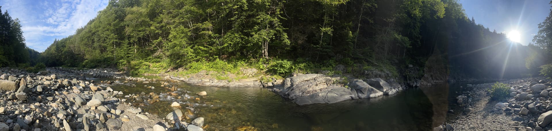
Rock River path — river bank and trail, Newfane, VT

Conditions

Air & rain

Tuesday, May 26

Next hours

Daily

Today

Tomorrow

Next

USGS

River level & flow

Water

Clarity, flow trend & rain

Community

Crowd & parking

Trail

Mud

Trail detail is loading. Expect uneven tread, roots, and mud after rain until the full read appears.

Wildlife

Nature

Pulse

Nature activity

Recent activity: strong

Wildlife mix

What’s showing up

Plants
Amphibians

Timing

Freshness

Recent activity this week.

Newest: 6d ago

Neighbor posts, not a census—fine for vibe, not for management.

Bugs

Mosquitoes & ticks

Bug watch

Bugs worth planning around

Mosquitoes

Picks up near sunset

Ticks

Tick check strongly advised

Sun

Light

Data & sources

  • Neighbor nature posts are not a species census; pulse is a loose blend for timing a visit, not land management.
  • River clarity and flow use USGS proxy gauges and NWS outlooks—see /legal — data sources.
  • Bug watch blends weather with Vermont official layers:VDH · mosquitoesVDH · ticksNot medical advice. “What it may feel like today” is weather- and time-driven; ticks follow season and where you walk. “Around Rock River” is separate—public maps when we can load them.