Local shorthand for a West River tributary in Newfane, Vermont—Windham County: cold water, a short walk through the woods, posted neighbors, and the same “Rock River VT” search string visitors use. Below: who shows up, how the place is used, where it sits on the map, how frontage was protected, and what stewardship means now.
Is Rock River a gay or LGBTQ-friendly swimming hole?
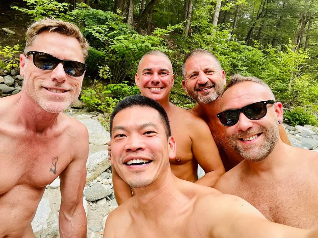
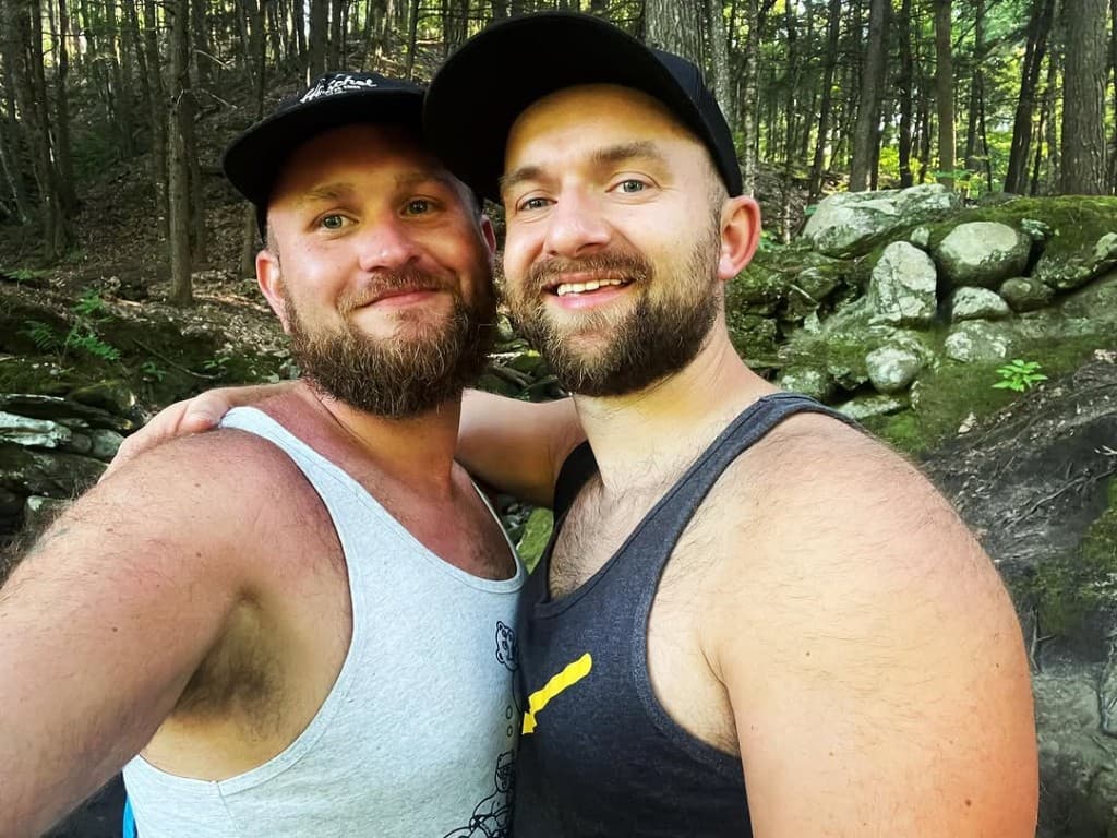
Rock River has long been known as an LGBTQ-friendly swimming-hole corridor in southern Vermont. Some visitors search for it as a gay swimming hole or clothing-optional river spot, but the safest way to describe the place is simple: it is a shared natural area where privacy, consent, posted signs, land care, and water safety matter.
For many people, Rock River is part of southern Vermont’s LGBTQ memory as much as it is a swimming-hole corridor. For a practical visitor version of this context, see the Rock River LGBTQ guide and Gay-Friendly Swimming Holes in Vermont. The LGBTQ guide explains where to start, what to check, how to protect privacy, and why respect keeps the place usable. If you are planning from Boston, Provincetown, Northampton, New York, or Montreal, also read the LGBTQ New England road trip page. For a full weekend arc, see Rock River gay weekend guide.
What is Rock River in Vermont?
Rock River is a southern Vermont stream and swimming-hole corridor associated with Newfane, Dummerston, Route 30, Depot Road, and the West River. Most visitors use the phrase to mean the lower river area, walk-in trail, ledges, pools, and shared shoreline where public access, private neighbors, and preserved land meet.
Where is Rock River in Vermont?
Rock River (sometimes written Rock River VT) is a short West River tributary in Windham County, with the most-visited reach running through the Newfane area and public access often approached from the Route 30 / Depot Road corridor. On a map, it is easy to mix up town labels, water names, and trailheads—use the site Rock River VT map and first-time visit guide together when you plan. For a deeper timeline, read Lower Rock River history.
Cold water on a West River tributary, a short woods walk from the Route 30 corridor, and riverfront neighbors have steered for decades. The bullets are the gist—what follows is the fuller picture.
Cold, clear pools and warm ledges after a short walk—you don’t need a big gear list.
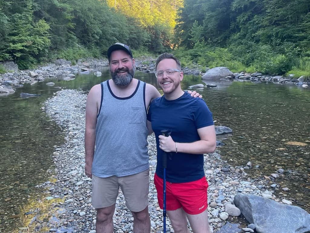
Locals, weekenders, and regulars. LGBTQ+ visitors have been part of the mix for a long time.
Flow and weather shift fast—check Conditions, then read what’s in front of you.
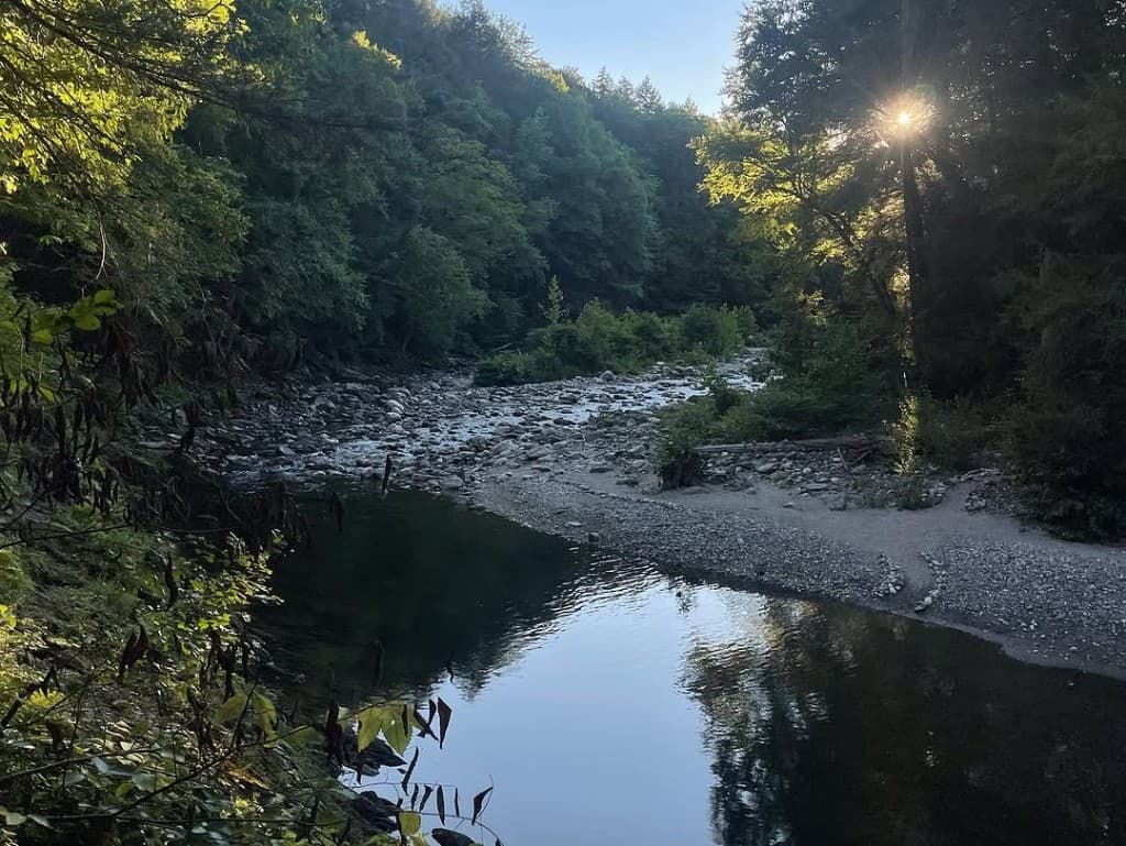
The woods walk people mean when they say “Rock River.”
Place
Why this place works
Cold water, short approach, mixed crowd. The next three blocks are the on-the-ground read.
What it feels like
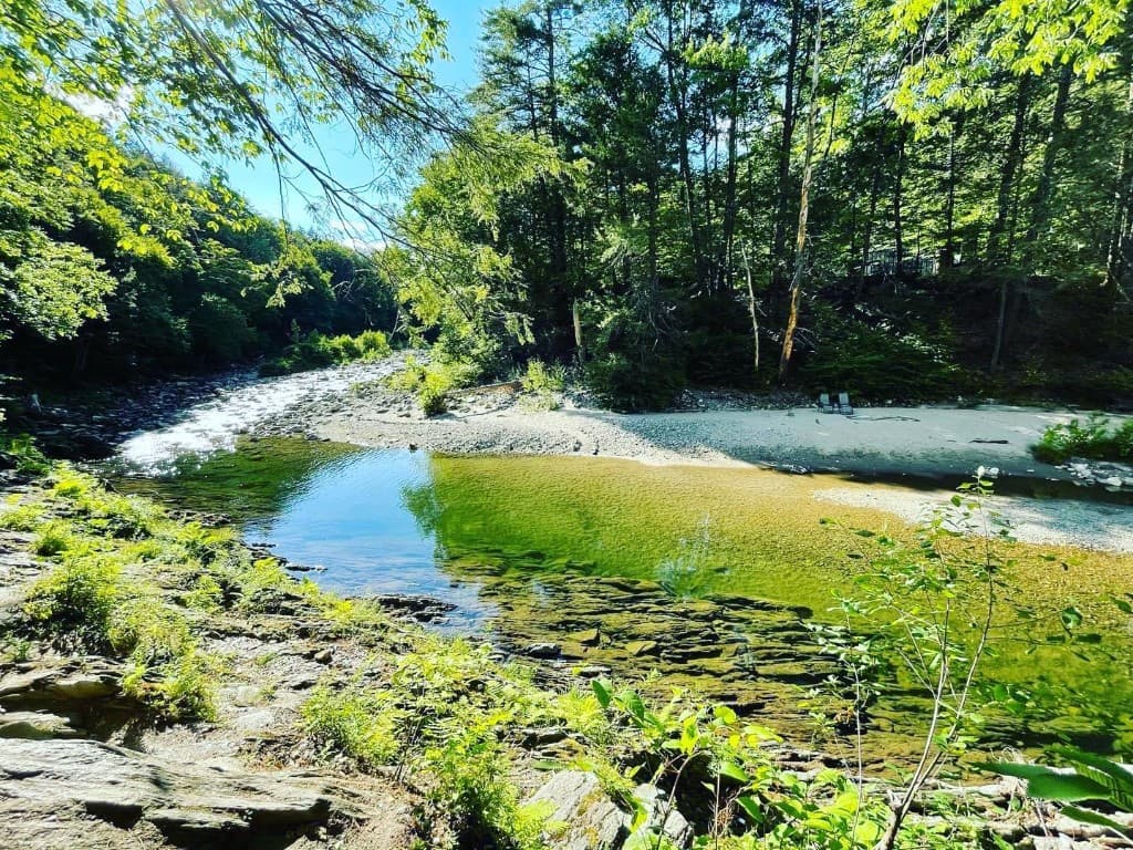
The water stays cold in the pockets. The ledges heat up in the sun. The woods are regular southern Vermont forest—birds, shade, mud when it’s wet.
Most people reach the pools in a few minutes from the car. No trail marathon.
Who comes here
Locals, weekenders, and people who’ve been coming for years. LGBTQ+ visitors aren’t new here—they’re part of the same crowd everyone else is in.
Most folks want space, a swim, and a quiet ride home. Clear safety and respect copy keeps the corridor workable.
How the river is used
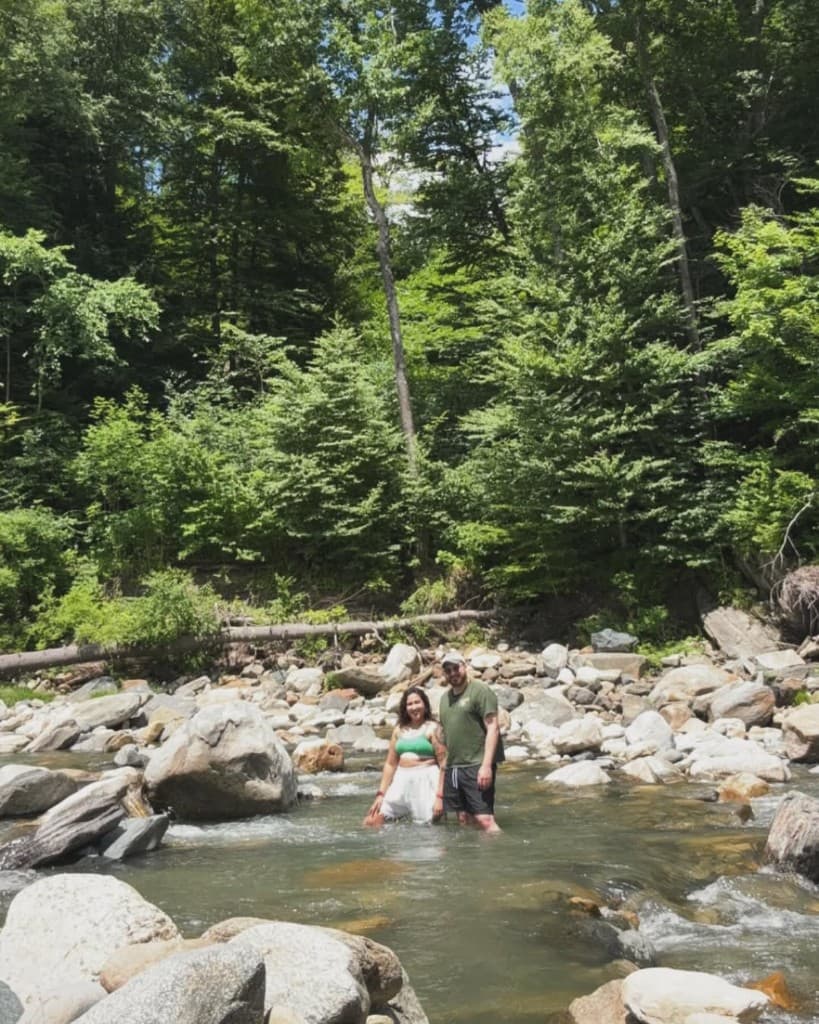
Swimming and sunning are the main events. Some people bring floats or wade with kids.
The stretches people name out loud—Indian Love Call, Third Beach, Fifth Beach—are laid out under Land & river, with the map and guidelines linked there.
Where next
Visit, map, conditions, preservation, Community, field notes—each in its own place when you need it.
Where the water runs, how you walk in, and how the named banks line up.
Lower reach: water, stone, and steady summer use.
Geography & context
Rock River is a West River tributary. The whole stream lies in Windham County, Vermont.
It rises in the Green Mountain National Forest in Dover and joins the West River in Newfane.
“Rock River” usually means the trails, Rock River swimming holes, and banks on the lower reach—stone, water, and years of careful use.
Public access is woodland paths plus the town trail system. Mud, rain, and snowmelt change traction week to week.
One pool can look fine while another is up or down—thinking watershed-wide explains a lot of spring surprises.
Areas, beaches & use patterns
Three names come up most. Each stretch has its own feel. All of them need space, courtesy, and pack-it-out habits.
Family-oriented beach
From the town path at the end of Williamsville Road, Newfane, you hit the family beach first— Indian Love Call—where kids and teens have swum for generations.
Middle reach — Third Beach
Farther in, Third Beach is a named stretch with posted shoreline norms. Read signs on site and protect privacy.
Sandy bank — Fifth Beach
At the end of the trails, Fifth Beach is the sandy bank locals name out loud—unofficial label, long use. It’s been a gathering spot for gay, bi, and queer visitors and friends.
Give people room. Same shore manners as anywhere else.
A mixed crowd needs everyone to ease off neighbors, land, and each other. Pack out trash.
Heavy weekends and hard weather stack up: litter, worn banks, parking stress. Left alone, that trims access and hurts the resource.
Neighbors organized buys and easements so the frontage people actually use stayed protected. The timeline and partners are in Human history; filings and programs live on Preservation.
Human story
Human history
Who moved first, what they bought, and when—then Land & river, preservation, and stewardship below carry geography and what happened next.
A volunteer-led preservation path
From the early 2000s on, people worried that development, erosion, and shifting access could chip away at a river day that had been shared for a long time.
Swimmers and walkers ran cleanups, watched for pollution, and nudged toward land protection. That work hardened into a nonprofit—still volunteer-run—alongside neighbors, the Vermont Land Trust, and the agencies in the loop.
Storms, slow negotiations, and fundraising rounds belong to the same story; the timeline below pins the order.
Timeline
2000
Summer 2000 — The Rock River Preservation Society forms
People who used the Rock River swimming holes start The Rock River Preservation Society to back ecological health, public access, and hands-on care—cleanups, alerts, and land protection. The society registers as a nonprofit the next year.
2003–2006
Watershed council, reorganization, 501(c)(3)
The Connecticut River Watershed Council (now Connecticut River Conservancy), worried it could not hold the land well enough on its own, talks to the society about a purchase. A wider circle of river users helps reorganize; Rock River Preservation, Inc. lands IRS 501(c)(3) status and a management plan aimed at erosion, access, and responsible use.
2007
March 16, 2007 — First riverfront purchase
Rock River Preservation buys roughly 4.5 acres of riverfront from the watershed council, with conservation protections held by the Vermont Land Trust.
2011
August 27–28, 2011 — Tropical Storm Irene
Tropical Storm Irene reshapes river landscapes across the Northeast, Rock River included. Volunteers reopen trails and clear debris.
2014
Conversation across the river
Rock River Preservation opens a conversation with Robert Swartz and his daughter Jennifer, owners of heavily used swimming areas across the river from the far end of organization-owned land.
2018
Summer–fall 2018 · closed November 20, 2018 — Community-backed land expansion
The Swartzes offer about 21.32 acres for sale. More than two hundred river users answer a community fundraising push with over $90,000; the purchase closes November 20, 2018.
Access and parking stay as they were—the point is to conserve the experience people have valued for generations, not to add camping or reroute public use overnight.
Rock River Preservation, Vermont Land Trust & neighbors
Rock River Preservation is the volunteer-led nonprofit that organizes care, closes purchases, and carries management plans on the ground.
The Vermont Land Trust holds conservation easements and protections that run with the land—structure that outlasts any single season or campaign.
Neighbors and river users supplied cleanup crews, a heads-up when something looked off, and the small donations that made the bigger buys possible.
What exists today
The thread above is what you’re standing in at the water: protected frontage, updated plans, and the same volunteer attention that shaped the buys. For acreage, road names, parking context, and the current stewardship frame, see Stewardship on this page and the Preservation section of the site.
These figures line up with the timeline above. Full deeds, easements, and programs: Preservation. Sequence: timeline.
About 25.82 acres of protected riverfront, with updated management plans for the whole parcel.
Roughly 1.2 miles of frontage. The strip reaches the Jersey barriers on Williamsville Road—handy if the town path from Depot Road isn’t working for you that day.
That holding covers the family beach and the bend most people call Third Beach.