Labels
Route 30 and Depot Road: Rock River access
Most people find the place by the Route 30 stretch near Depot Road, not by a clean town name in the GPS. Get the label story here, then trust the map and posted signs in the car.


Quick answer
How people actually find the parking
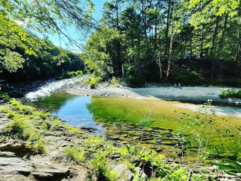
Think “Route 30 pull-offs near Depot Road,” not a single perfect town name. The Rock River map shows where most visitors start walking toward the main swimming and wading area.
Search labels
Why labels are confusing
The river and trail sit where GPS labels overlap: Newfane, Dummerston, Williamsville Road, the West River valley. Those are regions and roads, not one “official” parking lot. Follow legal pull-offs, road paint, and posted signs first.
Parking
Route 30 parking basics
Use only marked public pull-offs. If one is full, do not invent overflow on private land or narrow shoulders. Read Rock River parking and Brattleboro approach notes for trip framing.
Streets
Depot Road and Williamsville Road context
Locals and maps reference Depot Road, Williamsville Road, and the Route 30 bridge area in overlapping ways. Your job is not to win a geography debate in the car—it is to arrive at a legal space that matches the current map pin and current signs.
GPS
What GPS may miss
Routing apps can drop you in the “general area” while missing no-parking paint, one-way road quirks, and neighbor driveways. When navigation disagrees with a sign, the sign wins.
Neighbors
What not to block
Do not block gates, driveways, mailboxes, bus turnarounds, or fire lanes. If you cannot park cleanly, leave. Search traffic is hard on small roads—treat that as a reason to be extra careful, not a reason to improvise.
More